
At the Yarra Link Project, we are planning some low impact utility structures. The site has significant challenges regarding access for materials and the inevitability that at some stage it will be under about 5m of water (1:100 flood levels are 7.4m above average tide).
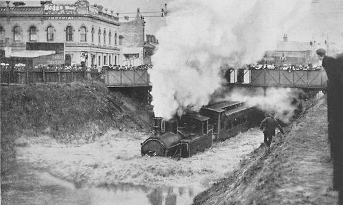
Chapel Street, 25 January 1907.
Stonnington History Centre’s online photo collection (Reg no. PH 491)
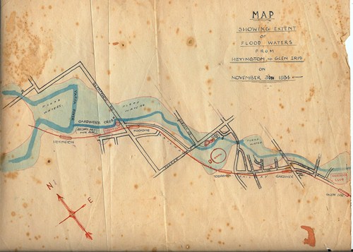
Flood Map 31 November 1934 by George Barlow (Reg no. MP 60081)
While such challenges seem unusual, it is estimated that 1/6 of the world’s population is prone to inundation by 1:100 yr flood events as humans disproportionately live in coastal and riverine environments. With climate change and predicted sea level rise, these exposures will affect more people in the future.
Urban environments often have complex and expensive flood mitigation works. In fact, the Yarra Link Project is located on a piece of land that was effectively created by excavation works to control flooding on the Yarra River. Fighting nature tends to be a losing game, however. Modern approaches to flood mitigation increasingly recognise that the best mitigation is reducing the damaging effects of flooding.
Some architects have taken this principle one step further by designing structures that float when flood waters rise.
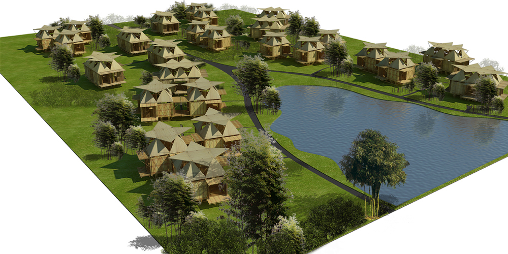
Floating Bamboo Homes by H&P Architects
Recent Comments